Natural skate park: Pawnee National Grassland

This tale was originally posted Nov. 16, 2004. There is so much goodness here, I just had to re-post it on the new site platform.
Date: Sunday, Nov. 14 2004
Place: Main Draw OHV Area, Pawnee National Grassland
Crew: Elliot, Jeff, Rob, Steve, Rufus and me
Mission: FREERIDING, baby, oh yeah!
 |
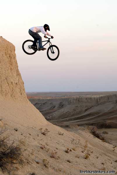
| Elliot Hoover knows how to ride a bike. And a hardtail no less. |
About two hours from Boulder, in the rolling prairie east of Fort Collins, lies the Pawnee National Grassland. This sprawling, diverse park offers fishing, hiking, camping and all that stuff. In one area — the Main Draw — erosion has carved a shallow canyon through the fine-particled dirt. OHV trails run up and down the gash, and numerous cliffs and small canyons drop in from the sides. The result is a roller coaster ride for OHVs and Audi A4s (heh heh), and a freeriding canvas for us mountain bikers.
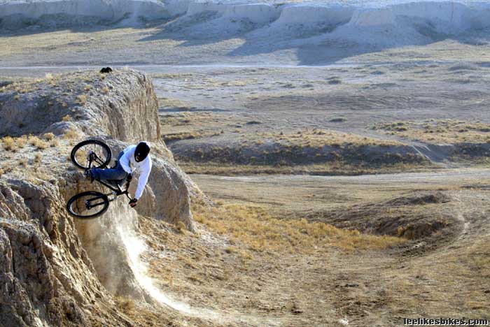
For the most part the motos stick to the bottom of the canyon, occasionally carving beautiful berms on the canyon walls or blasting up the steep chutes. The trails that exist require horsepower. To have fun riding a bike, you need to hike and use your imagination. The baked contours resemble a natural skate park. “Hmm, I could drop there, carve there and hip off of there …”
Since I’m a linear-thinking racer guy it took me a while to get the hang of it, but after a couple nice hits I was scoping lines with the rest of the boys. You can drop off cliffs into the ATV bersm, link natural humps into jumps, hip little promontories, ride skinny ridges and have a great time riding up the sandy walls. With a shovel and a sculptor’s eye, you can make pretty much anything you want. Heck, you could play an amazing game of line H-O-R-S-E out there.
Things to know:
The parking lot is full of goat head thorns. Carry your bike to the trail. And don’t let your three-legged dog run around.
Motorized vehicles are allowed only from November 1 to April 9, to give migratory birds somee peace and quiet.
OHVs are restricted to the main draw itself, which is a couple miles long. The north end is deeper, more convoluted and more interesting than the south end. We found tons of roll-ins and drops, and a sweet natural wall ride.
For directions, regulations and terrain photos: U.S. Forest Service page, DuneReview.com
Thanks to Jeff and Rob for taking some of the photos.


Comments are closed.